GNSS接收器 - 进化还是革命?
定位的过去,现在和未来
卫星测量…是否有任何行业专业人员(几乎)每天都没有使用它?Huibert-Jan Lekkerkerk写道,在过去30年中,GNSS已成为大多数应用的主要定位工具。当然,仍然有一些例外,需要正确的相对定位并使用专用的光学系统(例如总站或电平仪器),但是即使是使用GNSS技术确定的控制点也经常设置。本文研究了过去十年中GNSS的发展,并试图预测未来。
Around a decade ago, a review of GNSS systems would have entailed two types of systems. The most prevalent was the high-end RTK unit costing over €20,000, and the second type was the handheld GIS data collector. The main difference between them was their accuracy – centimetre versus (deci)metre level – and their antenna. The high-end systems all had a large antenna with an integrated receiver and separate controller that you had to mount on your survey pole, whereas the GIS types had a (small) patch antenna, receiver and controller integrated into a single unit. The only other type of system one could have were the machine control units for the construction industry; these were based on the same technology as the high-end RTK units.
Applications
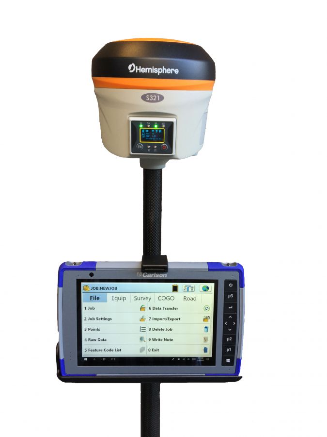
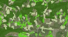
All the above instruments are still used today. The high-end RTK system still looks the same but has come down in price. And, where the standard setup in the past would be two units connected by UHF radio, most brands now offer that just as a choice. The main connectivity comes from mobile data networks with corrections sent over the internet. Rather than supplying a similar unit as a base station, most manufacturers now offer what they call a network receiver capable of transmitting (and receiving) network corrections (Figure 1).

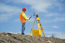
Another major development inGNSS receiversover the last few years is the integration of an ‘electronic’ bubble in the pole (Figure 2). Whereas in the past the pole had to be kept exactly upright for a correct position (and height) measurement, the modern receiver now has an integrated roll and pitch sensor like those in a smartphone. Using the readings from the sensor (and the antenna height), the position of the antenna is corrected towards the ground point up to an angle of 30 degrees. Based on this additional information it is possible to hold the pole at an angle and still obtain the correct position and height information. This not only makes accurate measurements easier; it also allows the surveyor to measure otherwise inaccessible points by positioning the pole at an angle.
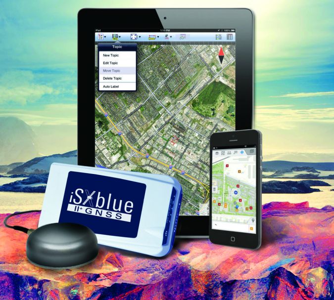
Taking the use of freely available satellite-based augmentation system (SBAS) corrections and post-processing of earlier GIS data collectors a step further, this type of receiver is nowadays capable of receiving RTK corrections as standard, thus allowing the collection of GIS data to centimetre level rather than metre level. Also, GIS receivers increasingly no longer have an integrated controller but rely on any Bluetooth connected device such as an Android smartphone instead (Figure 3).
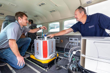
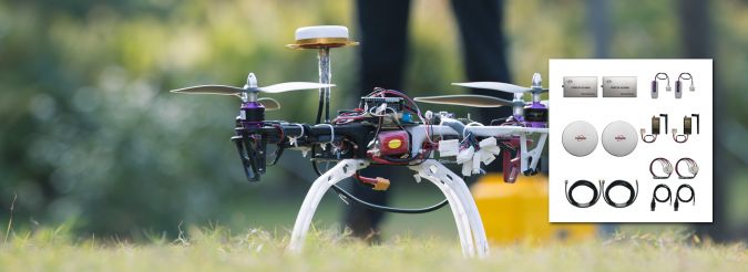
In addition to the receivers mentioned above, there are a multitude of small black-box RTK receivers designed specifically for use on unmanned aerial vehicles (UAVs or ‘drones’) or for machine control (Figure 4). Often these have a large integrated memory allowing them to (also) store raw data for post-processing, giving even more accurate positions.
GNSS星座
About ten years ago, GNSS life was simple for the end user: it was pretty much GPS or nothing. Glonass, the Russian GPS equivalent (and the first to reach operational capability in the early 1990s), had deteriorated due to the economic crisis at the end of the 1990s. Glonass was revived a few years later, getting back to full operation about five years ago.
At the same time, although we all used GPS, another system was becoming ‘the talk of the town’: Europe’s Galileo. Set up as a public-private partnership in the early 21英石century, it was reshaped into a government-only (but still civilian) system. Although Galileo is not expected to reach full operational capability until sometime in 2020, the reception of Galileo signals already benefits positioning quality.
Last but not least, seemingly out of nowhere, has come BeiDou, the Chinese GNSS. It was initially set up as a regional system, but the Chinese were quick to start launching satellites. With 23 satellites in orbit (of which a considerable number are indeed regional), there is now full capability over central Asia and initial capability in the rest of the world. In other words, for those using their receivers in central Asia it is worthwhile to ensure that their system also has BeiDou reception.
System Developments
但它不仅仅是卫星系统的数量that have increased from 1.5 GNSS to over four GNSS in the last ten years; developments within the systems have also taken place. On 24 December 2018, almost five years after the original plan, the first GPS-III satellite capable of new (and more accurate) positioning signals was launched. In 2020, the first launch of Glonass satellites with a full range of so-called CDMA signals is expected to bring the system onto the same signal basis as the other GNSS.
十年前,一个具有80个通道的接收器将被视为技术先进的,但现代接收器需要超过500个频道,以便最佳地支持来自当前四个GNSS的所有信号(图5)。毕竟,单个卫星在单个GNSS中的单个频率中的单个信号在GNSS接收器中占单个通道,并且每个GNS在空间中具有25至30个卫星,每个GNS在空间中具有25至30个卫星,每个GNS在大约三个频率上播放了两到三个信号。
Correction Signals and Accuracy
仅收到四个GNSS的信号并不能为专业用户提供所需的准确性。仅四个GNSS(或组合)中的任何一个中的任何一个标准定位均为仪表级。但是,对于任何现代职位,子米的准确性都是普遍的要求。为了达到更高的精度,需要校正信号。最常见的校正信号是免费的SBA,例如美国人瓦斯or the EuropeanEGNOS。These signals, which are broadcast in many parts of the world from the various SBAS systems, can be received by all GNSS receivers, whether they are professional ones or inside a smartphone. SBAS corrections make it possible to achieve an accuracy of around one metre.
对于那些需要更好准确性的人,标准校正信号是实时运动学(RTK DGNSS或RTK)。作为标准,所有专业的RTK接收器都可以运行RTK GPS,而大多数也可以支持RTK Glonass校正。目前,没有接收器提供的GPS和GLONASS RTK解决方案还多,但是制造商正在研究RTK溶液中的GPS和Glonass以外的Beidou。但是,即使在RTK解决方案中使用了“仅”两个GNSS星座,对于大多数竞争RTK的接收器,电流精度也小于1cm + 1ppm + 1ppm(68%)水平和1.5厘米 + 1ppm(68%)垂直。借助现代的网络类型RTK,单个基础RTK早期的15公里范围限制已被虚拟网络内的要求所取代并具有Internet连接。
The use of precise point positioning (PPP)是土地调查行业的新手,但在海上测量社区中一直很常见。有了这项技术,可以在距离基站相当远的地方实现准确的水平和垂直级别。在PPP中,基本站用于找到对原始卫星位置信息的准确校正,而不是SBA和RTK(用于计算差分校正的基本站的情况下)。Roving接收器使用此信息来计算改进的位置,从而使第一个“收敛”时间约为20分钟。由于PPP校正信号是专有的,因此并非所有接收器都可以使用PPP校正信号(图5)。所有PPP解决方案提供商都提供GPS校正,有些也可以与其他可用GNSS的组合使用。
Anti-jamming and Anti-spoofing
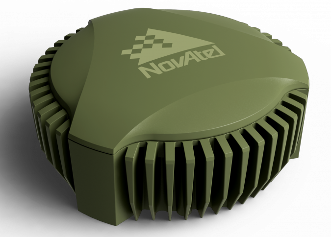
Whereas a decade ago GNSS was a mainly a professional tool, apart from perhaps being an expensive consumer accessory for in-vehicle navigation, it is now integrated into many applications – principally as a positioning system but also as an accurate basis for timing. With ‘autonomous’ being the buzzword in the navigation industry, the reliance on both accurate and reliable positioning is increasing by the day. Where reliable positioning is needed, the challenge is not only to tackle weak satellite or correction reception, but also to avoid interference. After all, in view of the rising number of autonomous cars, drones and even ships, a GNSS outage anywhere could quickly lead to all sorts of potentially serious issues. It is relatively easy to ‘jam’ GNSS signals (causing loss of signal) because the signals are weak. This is not always intentional. A few years ago, a legal argument was fought out in the USA between LightSquared and the American GPS community over LightSquared’s proposed transmission network due to its interference risk. This illustrates the concern about GPS jamming. In the end LightSquared went bankrupt (and was recently refloated asLigadowith a GPS-friendly solution). Even more potentially dangerous is what is known as ‘spoofing’, in which the original signal is intentionally replaced by a stronger incorrect signal. Tests have shown that if this is done subtly, many receivers and applications will start to follow the incorrect signals, which could ultimately cause ships or aircraft to collide or military troops to be directed off course. To counteract these effects, industry-leading manufacturers such as NovAtel are not only researching anti-jamming and anti-spoofing solutions but are also introducing new antennas that are more resistant to jamming (Figure 7).

Into the Future
在过去的十年中,技术显然取得了进步。主要的变化仅是一个完全运行的GNS(即GPS)到当今四个(几乎)完全运行的系统。但是也做出了其他改进。结果,我们将看到市场上出现更多渠道的接收器。在接下来的十年中,没有任何根本变化。最大的变化是从当前的FDMA信号结构转变为与其他GNSS互操作的CDMA结构的变化。
On the technical side, receivers have changed too and – even more importantly – accuracy has been improved across the board, with RTK becoming the standard. Over the next decade we will see new systems bridging the gap between RTK and PPP allowing sub-decimetre-level positioning anywhere in the world and reducing initialization times from the current 20 minutes to a couple of minutes for the first start and to mere seconds after a loss of signal. One of the other changes that is hoped for is the introduction of the Galileo Commercial Service, not only as a free-of-charge PPP alternative but, perhaps more importantly, as a standard to facilitate interoperability of the current PPP solution providers’ PPP signals with any GNSS receiver. Lastly, we will see anti-jamming and anti-spoofing solutions becoming more available, with price levels coming down to the current levels of ‘standard’ equipment.