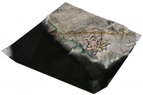
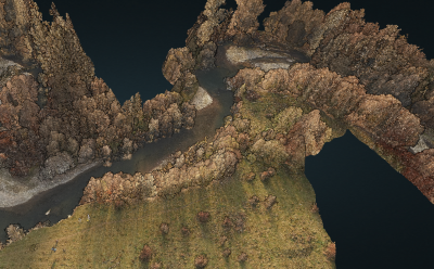
Lidar Survey in Cloudy Conditions in Cameroon
In Lidar surveys, minimizing flight time is the key to minimizing costs. Operators therefore carefully optimize parameters such as flight altitude, field of view and pulse repetition frequency to cove...

28 March until 29 April 2022
During the Aerial Mapping & Earth Observation Theme Weeks, we will take a detailed look at the latest aerial mapping solutions and processes, along with the ever-expanding range of products and services derived from such systems. We will also climb to greater heights as we expand our scope to mapping the Earth using satellites, including SAR imagery, space-borne Lidar and optical-range Earth observation data.


In Lidar surveys, minimizing flight time is the key to minimizing costs. Operators therefore carefully optimize parameters such as flight altitude, field of view and pulse repetition frequency to cove...
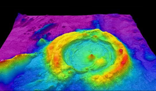
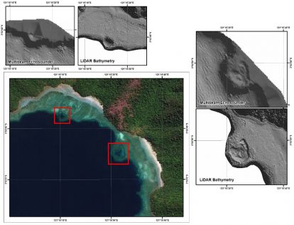
The monitoring of submerged deadwood and vegetation is gaining increased attention due to their socio-economic and ecological importance. Deadwood acts as an important underwater habitat but also pose...
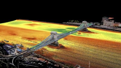
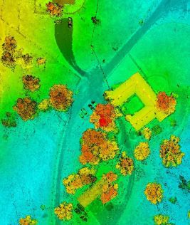
Two Hungarian companies designed a three-step data collection workflow to overcome the challenges in this urban surveying project, which included the use of UAVs and remote-controlled boats for Lidar ...
Nowadays, both image-based solutions and laser-scanning methods are evolving rapidly, but there is much debate about which technology is more efficient. Integrated airborne sensors, in which imagery a...

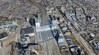
Deutsche Bahn AG has awarded a multi-year tender to Datumate for the analysis and visualization of drone images related to its railway infrastructure. Datumate is a leading provider of construction da...
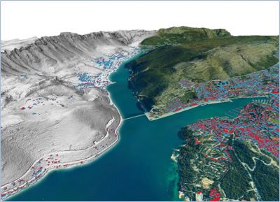
Smart digital realities that replicate real-life geoinformation provide valuable insights and support the analysis and interpretation of infinite data inputs from the real or digital world. They can b...

Airborne photogrammetry has been around for more than a hundred years. As early as 1851, the French inventor Aimé Laussedat began imagining the possibilities of using the newly invented camera to cap...
Surveyors and GIS professionals have the highest standards when it comes to their tools and trade. It is therefore no wonder that many surveyors are turning to drones for their mapping and 3D modell...
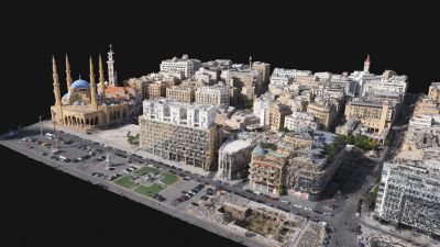
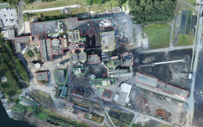
Following the devastating explosion of an ammonium stockpile in Beirut in August 2020, a UAV mapping project was rapidly initiated to assess the damage. The project was led by Augment, a small Luxembo...
 X-ray Function
Construction sites and, especially, demolition sites are often challenging environments for surveyors. Nevertheless, effective project management and financial control depend on accurate and timely in...
This site uses cookies. By continuing to use this website, you agree to ourCookies Policy.Agree