BIM,GIS,IoT,BMS,遥测和CAD都有什么共同点?
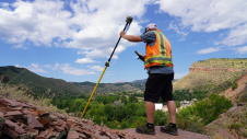
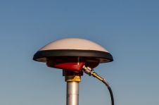
在过去的三年中,建筑信息建模(BIM)在世界范围内经历了快速发展。建筑资产的设计,构建和运营的价值链面临着各种变革的挑战,其中一些具有技术性质。其中包括从2D绘制到3D建模的过渡,并具有对象参考和链接信息。There is also an explosive increase in the volume of data on projects, including from new recording methods such as unmanned aerial vehicles (UAVs or ‘drones’), lasers, geo-radars, and the increased use of sensors and data transfer devices on the Internet of Things (IoT). As that data comes in so many shapes and sizes, there are continual efforts to enable interoperability. In connection with integration, we need to ask ourselves: what do BIM, GIS, IoT, BMS, telemetry and CAD all have in common?
首先,让我们探索“互操作性”的含义。可互操作方法使用固定的模式,该模式可以实现两个符合性应用程序之间数据的理论双向交换。但是,由于大型软件供应商的技术合规性以及设置此类工具的复杂性,该方法在数据交换和双向支持方面都证明是不可靠的。
Therefore, we should perhaps be more concerned with data integration which connects a superset schema to enable all data to be exchanged, whatever it may be. This is especially attractive in this area of engineering due to its complexity and the ever-expanding need to incorporate other contextual data to add operational and service value to asset information.
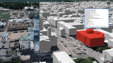
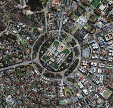
In connection with data integration, we need to ask ourselves what BIM, GIS, IoT, BMS, telemetry and CAD all have in common. The answer: they are no ordinary data; they all benefit from being geolocated in some way. Many professionals in the world of GIS have long understood the benefits of geolocation. In engineering, on the other hand, the approach to geolocation has often been from the microscopic perspective of the asset being built relative to itself, rather than relative to the wider world or city view.
This micro/macro perspective is interesting as it starts to provide context for the challenges of integrating geolocated information. At first glance, it looks easy. After all, there are only so many types of location methods. We can map from one to the other, so geolocation must surely provide the ultimate primary key to all data in the world, right? Well, maybe, but is this really true?
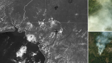
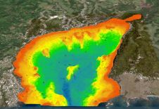
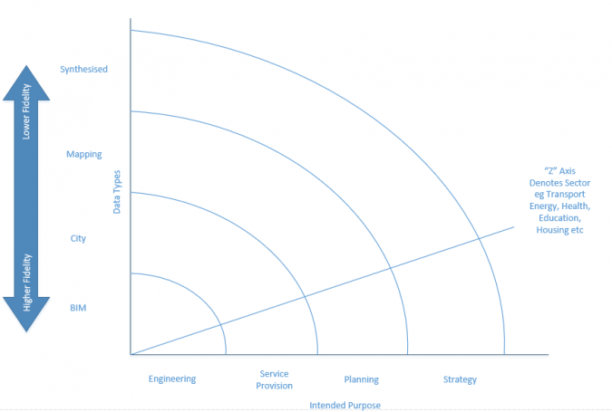
在GIS社区中,网格(包括蛇),拓扑,移动的网格和行星的问题都不如我们想要的那样圆形。一个不太讨论的更广泛的挑战是:即使我们将上述所有数据类型进行地理位置,我们该如何处理这些信息?数据的状态和忠诚度如何影响其安全使用的能力?该图显示了许多不同的数据类型和潜在用途。
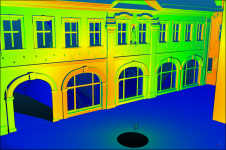
这说明了参与建筑和自然环境的庞大社区的每个部分如何开发出适合其需求的生态系统。工程和架构正在朝着对象描述的几何和数据的综合世界迈进。几何学的准确性可能是多个小数点的。但是,典型的结构耐受性可以高达50mm。当我们沿轴线移动并降低数据的保真度时,用例就会发生变化:从服务提供到计划和战略目的。数据还具有时间分量;它随着资产的年龄而衰老。简报数据与移交数据大不相同,而紧急物联网世界提供的传感器数据提供了另一个维度。
This leaves us with another fascinating question: which piece of data is correct, and how do I know I have that piece of data in front of me to solve my current problem? Data provenance and state are two concepts we have not heard about much to date. But get ready… you soon will.
使您的收件箱更有趣。Add some geo.
Keep abreast of news, developments and technological advancement in the geomatics industry.
免费注册