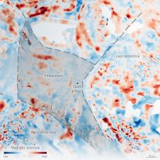
卫星图像:空中替代品
遥感项目通常从一个问题开始:“我应该使用空中图像还是卫星图像?”。在长期项目中,这个问题可能会再次出现,尤其是当无法预料的情况改变收集数据的能力,数据的可靠性或工作范围时。预算,技术和政府限制不断变化,因此选择正确的数据输入至关重要。
There are a number of key parameters that must be taken into account when beginning any remote sensing project. These include the size and accessibility of the area of interest, the timeliness of the data, whether the data can be sourced from existing imagery or if a new collection is required, and perhaps the most important aspect: the project budget.
效率和规模
卫星比飞机可以更有效地完成遥感项目,从而对成本效益分析产生巨大影响。关键区别在于卫星可以在几分钟内收集数千平方公里的速度和便捷性,而无需飞机飞行计划的复杂物流。飞机面临更大的限制:他们必须获得空域许可证,计划合适的起飞和着陆点,并遵守不断变化的边界和旅行限制。飞机也容易受到天气状况,例如大风。卫星根本没有这些问题。他们可以轻松地从孤立,冲突或跨境位置收集数据。这特别适用于可能需要多个载人或无人飞机的大型映射项目。这些节省在预算/时间敏感的政府地图项目中非常重要。

任务和处理
The planning of satellite tasking is fully customizable. This allows users to prioritize their areas for collection, define the resolution and spectral bands as well as specify collection angles. There is added flexibility for complex projects to adjust these requirements shortly before the acquisition takes place. Real-time weather updates ensure that the data acquisition will be as cloud-free as possible, further narrowing the competitive gap between aerial data and satellite imagery. After collection, satellite imagery is directly downloaded through a ground station where it can be delivered to the user within hours of collection. Users can choose from several processing options and delivery methods.
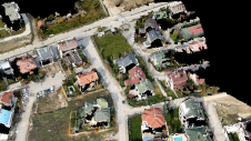
收集功能
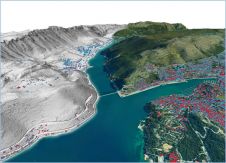
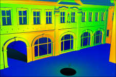
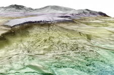
卫星图像提供者s can collect data in various multispectral band combinations as well as stereo imagery in a single pass, eliminating the need for multiple flights by multiple specialized aircraft. Stereo imagery offers reliable data for the creation of Digital Elevation Models (DEM) and virtual 3D reconstructions. The suitability of 30cm satellite imagery for aerial imaging applications is confirmed by the National Imagery Interpretability Rating Scale (NIIRS), which is used by the imaging community to define and measure the quality of images and performance of imaging systems. Imagery captured in 30cm from Maxar’s WorldView-3 has a rating of NIIRS 5.7. This means that it is possible to identify objects such as above-ground utility lines in a residential neighbourhood, impervious surfaces, crop species and their boundaries, vehicle types, manhole covers and much more.

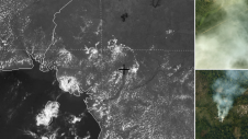
永久关注
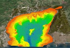
卫星可以到达难以到达或通过其他方式无法访问的领域,并提供可预测且频繁的刷新时间表。使用高频刷新率,用户可以自信地要求以特定时间间隔收集完全相同的感兴趣区域。这是自动分析的关键特征。与空中数据一样,卫星图像也可以使用人工智能将其集成到程序中,以自动提取和分类功能,从而简化工作流程。与空中相比,卫星随时间收集的图像量为机器学习计划提供了增加的培训数据。此外,用户可以利用历史数据来模拟预测分析,这些分析对于趋势分析,大规模检测和盈利能力估算非常有用。
使您的收件箱更有趣。Add some geo.
Keep abreast of news, developments and technological advancement in the geomatics industry.
免费注册