在马拉维将无人机映射付诸实践
This article was originally published inGeomatics World。
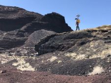
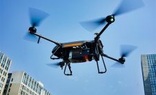
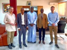
无人机技术已经改善,到了起飞比以往任何时候都容易的程度。诸如PIX4DCAPTURE之类的飞行计划应用程序可帮助有抱负的飞行员乘坐天空。但是接下来会发生什么?2017年,马拉维政府和联合国儿童基金会政府推出了一条空中走廊,以测试无人理目的使用无人机的使用 - 非洲第一个是全球最早的无人机,重点是人道主义和发展。在这种情况下,联合国儿童基金会马拉维在首都莉隆威举办了为期3天的研讨会举办了Pix4D,针对来自各个部门的当地参与者。研讨会的目标是了解他们如何有目的地计划,捕获和处理并将无人机数据应用于其工作中的更多信息。
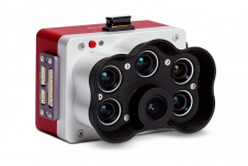
一旦空降,无人机是使用RGB,热或多光谱图像捕获现实的详细2D和3D表示的绝佳工具。获取准确的几何和辐射测量值也是如此 - 但所有这些都需要必要的技能。马拉维灾难管理事务部IT官Incent Chifundo Manyera说:“马拉维人能够驾驶无人机。”DoDMA)。“但是缺少的是使用无人机捕获的数据的实际处理。在短时间内进行处理,并且能够在短时间内进行处理,从而获得准确的结果。”她补充说:“如果您不包括数据处理,则驾驶无人机是什么都不是。”
Drones for good in Malawi
Tautvydas Juskauskas, drone lead at UNICEF Malawi explains: “Together with other partners in international development and the humanitarian sector within Malawi, we are increasingly using drones for various purposes. We use drones for medical commodity delivery, but also we are using drones more and more to capture aerial images and then create orthomosaics, 3D models and other digital outputs that would help us for emergency response, but also for our key programmatic activities.
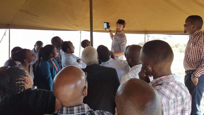
从习俗说话Pix4DWorkshop in Lilongwe, Malawi, Juskauskas continued: “The increasing demand has suggested that we need to build the local capacity of our academic and governmental partners... That’s why we came to the idea of this workshop: to gather people from different sectors. Private, non-profit, academic and government. This workshop is to raise awareness of existing photogrammetry tools but also to increase their capacity in validating the aerial imagery, processing it and meaningfully using it for many different purposes.”
The participants were from a diverse range of fields. They included a hydrologist; physical planning and GIS officers; a cartographer, surveyor and photogrammetrist, as well as a lecturer in forestry and a professor in geosciences.
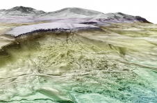
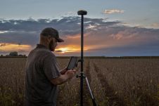
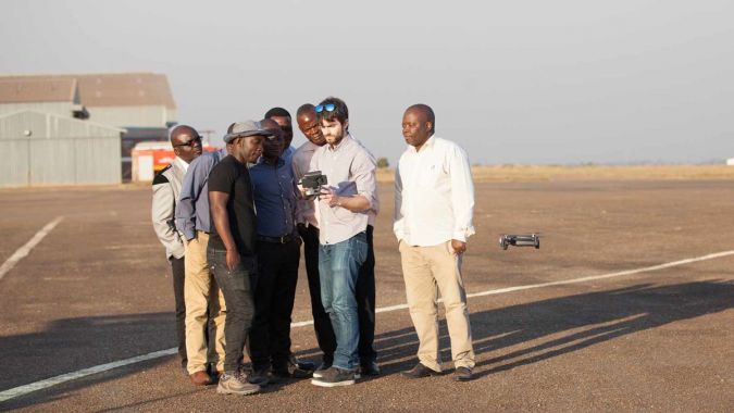
In the three-day workshop, the group learned how to produce accurate 2D and 3D representations of reality with RGB, thermal, or multispectral images. Additionally, they were trained in how to acquire accurate geometric and radiometric measurements, as well as sharing deliverables with stakeholders. The workshop was hands-on, including planning and flying drone missions at old Lilongwe airport.
Christopher Chikaonda Sinkonde评论说:“我永远不会忘记驾驶无人机。这是最奇妙的经历。”Sinkonde是GIS和地图官马拉维调查系。“The Department of Surveys is the only department which is responsible for map production in the country,” he says. “One of the key benefits… is a drone can map a certain geographical area in a couple of minutes, and the data can be processed in a few minutes or hours.”
他补充说,他希望获取无人机和Pix4Dmapper for use in the Department of Surveys, as the updated maps could save both money and time. “With the drones, we should be able to provide the updated maps at a reasonable price... Pix4D training will enhance and improve our mapping technology.”
联合国儿童基金会马拉维和pix4d
更新的调查地图并不是联合国儿童基金会想要将PIX4D培训带到马拉维的唯一原因。Juskauskas解释说,2019年3月,一场洪水破坏了马拉维,影响了70万人。洪水泛滥之后,联合国儿童基金会马拉维的无人机团队加入了机构间评估小组。
Juskauskas说:“我们意识到我们确实需要其他分析工具来处理所有数据。”“这是当我们要求Pix4D团队帮助我们处理数据时。”
Even after the assessment was complete, the UNICEF team stayed in touch. “There is a demand in Malawi among academics as well as government entities to really learn more as to what is photogrammetry and what are the tools to analyse aerial imagery. That’s when we decided we wanted to collaborate on this workshop,” says Juskauskas.
The next generation of photogrammetrists
这样一个学者就是Chresceuntia Matambo Msasa,他是地理学讲师University of Malawi Polytechnic College.
A classically-trained photogrammetrist, Msasa is excited by the possibilities of drone mapping. “Previously we used to have big machines for image processing, but with this new technology we can actually fly the drone!” she says. Msasa sees the value of drone mapping in accademia: “We can use it for data collection during research and we can also use it for teaching our students how to collect geospatial data.”
生态学讲师Richie Muheya同意。他自己的研究包括在全国范围内绘制生态系统。但是,“我们在马拉维没有很多空间信息差距。这项技术使我们有机会几乎简单地创建空间数据……我认为这对我来说确实是一个机会。”
He adds that “A lot of students in our university are very excited about technology. So this is a different way that we can teach them when we teach them about spatial ecology or landscape ecology and the different technologies that are now out there.”
Juskauskas同意。他总结说:“很高兴看到对使用无人机技术进行开发,弹性,应急准备,计划和研究的兴趣越来越大。我的希望是,在接下来的几年中,我们在马拉维有一个充满活力的无人机生态系统,重点是通过可扩展的无人机操作,本地能力建设和创造商机的实际问题解决。”
The original version of this story was published byPix4D。