Aberystwyth University Invests in UAV Lidar
This article was originally published inGeomatics World.
The Earth Observation and Ecosystem Dynamics Group at Aberystwyth University has invested in a drone based Lidar and spectral imaging package in order to enhance their research across the globe.
定制的单位,由COPTRZ配置expected to significantly enhance the university’s research into the monitoring of British forests, focusing primarily on the measurement of standing timber volumes, forest biomass and carbon content.
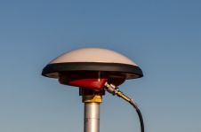
After an in-depth consultation, COPTRZ were able to recommend their Volant UAV Lidar system which will enable survey grade point clouds to be captured using a sub 20Kg drone linked to spectral imaging data. The data captured will then be used to monitor the successful transition of plantation forests to Continuous Cover Forestry, a forest management approach that seeks to increase the ecological diversity of British forests.
“Aberystwyth University owns several fixed-wing and multi-rotor UAVs and we have now added to the fleet with a Lidar unit that will enable the direct measurement of forest attributes such as tree height, stocking density and canopy cover,” said Osian Roberts, PhD Student at Aberystwyth University. “We anticipate that the proliferation of UAV technologies over forthcoming years will enhance opportunities for the collection and analysis of remotely sensed data, presenting our students and researchers with an opportunity to increase our knowledge of our environment.”
Make your inbox more interesting.Add some geo.
Keep abreast of news, developments and technological advancement in the geomatics industry.
Sign up for free