Mosaic Integrates Mobile Mapping Camera with External GNSS to Achieve RTK
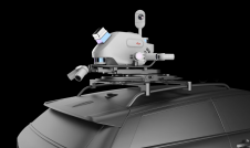
The Mosaic 51, a 360-degree mobile mapping camera, now has extended capabilities, as it is fully integrated with external GNSS to easily achieve RTK. For customers with a high demand for precise position data, Mosaic’s solution can easily grant centimeter level accuracy, utilizing RTK (Real-Time Kinematic).
它还可以帮助收集位置绝对伏特加e accuracy in challenging conditions like urban canyons – which can pose a huge challenge for standard GNSS positioning systems.
In its three years in production, the Mosaic 51 has already gained recognition as the go-to mobile mapping solution for street-level truth with its best-in-class ground level imagery, thanks to its 72MP resolution with 6x12MP image sensors, granting full 360-degree image capture. It is among the highest resolution mobile mapping cameras available.
TheMosaic 51is a single unit mobile mapping camera, with an embedded computer, so that users do not need a dedicated computer within the vehicle to operate and capture data. The idea is that this makes it more functional and mobile than traditional mobile mapping systems which are larger, heavy, and require additional pieces of equipment. The stand-alone unit currently possesses a built-in GNSS receiver with an accuracy of about 1.5 meters. However, capitalizing on the power of RTK, a specialized form of differential GPS, users can achieve 100 times greater accuracy over standard GPS.
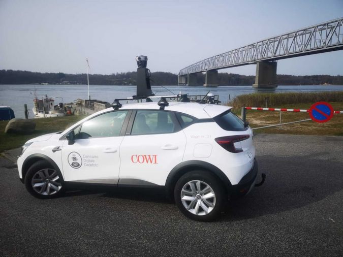
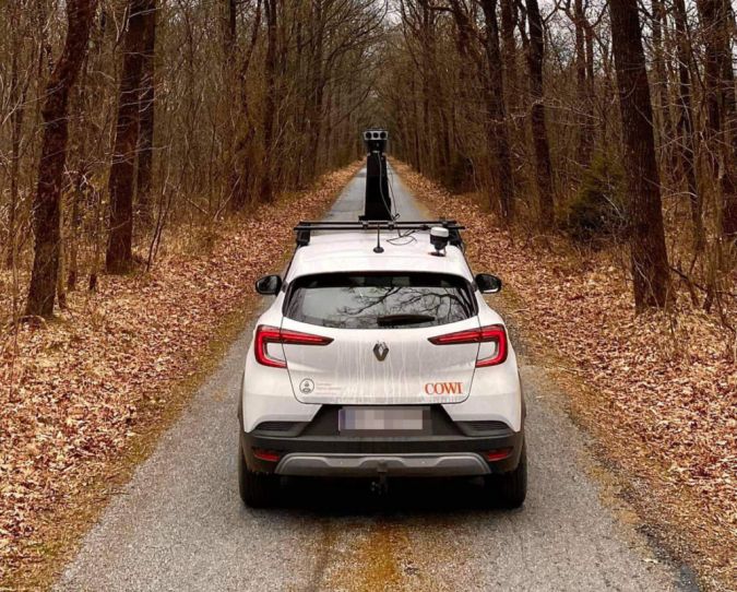
Mosaic 51 integrated external GNSS use cases
This latest update gives Mosaic customers the highest image resolution as well as high position data precision. The Mosaic 51 integration enables RTK for GNSS positioning of the captured image data, which mapping and surveying companies, as well as infrastructure and utility companies, can use later to pair with highly precise geographic coordinates.
The camera came to be from the demand in the mobile mapping and GIS surveying markets for higher image quality. This imagery has a multitude of applications, such as road surveying and maintenance, infrastructure and cadastral surveying, CAD/BIM, GIS surveying, public safety and utility and telecom companies
Now the Mosaic team has ensured that in addition to having the clearest image possible for a mobile mapping device, it also has some of the highest precision with centimeter-level accuracy.
Not only can the camera now capture cracks in the road but, “you can see when the vehicle is changing lanes,” said Rostislav Lisovy, co-founder and vice president engineering ofMosaic.
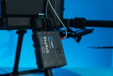
Multi-band RTK GNSS receiver
The GNSS chosen for the integration is theEmlid Reach RS2a multi-band RTK GNSS receiver with centimeter precision. This was due to several factors including functionalities as well as its price point. This makes it more accessible and scalable to more companies. The durability of the Reach RS2 compliments the robustness of the Mosaic cameras. For example, the M51 is built to operate for a full day and in less-than-ideal weather and road conditions.
The Mosaic integration is being extended to the newly released Mosaic X as well. Both current and future Mosaic customers can now benefit from this integration.
Make your inbox more interesting.Add some geo.
Keep abreast of news, developments and technological advancement in the geomatics industry.
Sign up for free