LIDAR,图像和数字林业的Insar
GIM International interviews Benoît St-Onge
Benoît St-Onge is a professor at the University of Quebec in Montreal, Canada. He works at the Department of Geography with a major research interest in 3D remote sensing for forest analysis. 'GIM International'recently interviewed Professor St-Onge to gain a better understanding of the challenges and innovations in this field.
(By Martin Kodde, contributing editor, GIM International)
In your research work, you have a clear focus on the use of Lidar and photogrammetry for analysis of vegetation, forests, etc. How did your interest in vegetation develop?
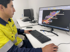
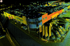
当我选择从事遥感在马ster level in the 1980s, eastern Canada was invaded by a plague of insects that depleted leaves from trees. I worked on mapping tree defoliation using images from the Landsat satellite, which had a spatial resolution of 30m, but I was frustrated by the fact that I couldn’t see the individual trees. That’s why I decided to work on high-resolution images for my PhD, at a time when commercial high-resolution imagery was not yet available. Since I wanted to study the link between forest structure and image texture, I ended up synthesising thousands of 50cm-resolution images of artificial canopies using simple 3D models of trees. A few years after completing my PhD, I discovered airborne Lidar, which provided me with the actual 3D representation of the forest directly. My use of photogrammetry came a few years later, initially to obtain better reference data for tree height. That’s how the idea of combining Lidar and photogrammetry emerged.
激光雷达技术已在林业中使用了一段时间。这项技术如何影响森林和植被管理?
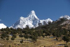
We’re starting to see an impact in several countries. In Norway, almost 100% of forest inventories have become based on Lidar. Other Scandinavian countries have followed a similar path and we’re seeing more and more countries adopting Lidar for forest mapping. Here, in the province of Quebec, forest inventory is rapidly evolving towards intensive use of Lidar and there will be Lidar coverage from the US border up to the 51stparallel by 2022.
After a slow start, adoption by the forest industry is quite rapid now. Lidar is used to optimise the layout of forest roads, to find small intermittent streams for protection, and to estimate timber volumes. Knowing exactly where to send the harvesting machinery optimises the value chain while improving habitat protection.
3D forest mapping only adds value if this process is repeated frequently. However, the current costs are prohibitive. Do you believe a higher temporal frequency can be achieved?
This is indeed a real issue. It’s quite clear that the impetus for large-area Lidar acquisition comes from the fact that a wide range of users want an excellent digital terrain model (DTM) for use in hydrology, civil engineering or risk assessment, while the forest community is looking for accurate forest information. The DTM is not expected to change rapidly, but of course the forest will evolve quickly. This leads to situations in which the forest users want updated coverage, while the DTM users are still satisfied with the old DTM.
我们会仅仅看到森林社区的需求足够多,以便定期进行大量土地调查?这远非确定。在森林覆盖有限的小国中,可以考虑常规的机载激元调查。例如,西班牙,该国的36%被森林覆盖,每六年都有一次重新飞行激光雷达的计划。但是,除非新技术急剧降低了激光雷达的成本,否则我认为这在加拿大或美国没有发生。这就是为什么我们越来越多地听到有关将摄影测量与激光雷达相结合以更新森林高度信息的原因。
You’re a strong advocate of the use of dense image matching as an alternative to Lidar. What are the benefits?
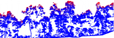
We’ve seen considerable progress in terms of image matching solutions in recent years. First, flight configurations are evolving towards a high forward overlap of 80%. It doesn’t cost much more than the standard 60%, but considerably helps the matching process by deploying multi-ray matching techniques. The algorithms are also more sophisticated and speed has increased. The results we’re seeing from the best software solutions are astonishing in terms of point density and accuracy. In our comparisons between photogrammetric point clouds and Lidar, we showed that even individual trees can be resolved in the photogrammetric surface models. By subtracting a Lidar DTM from the photogrammetric surface model, we get a very good canopy height model from which attributes such as height, timber volume and biomass can be extracted. Aerial photos can be acquired from a higher altitude, at a faster flying speed and at a lower cost than Lidar – plus you get information in full colour.
Do you believe both technologies will continue to co-exist or will we see one edging out the other
We will always need a technology to map the bare earth topography accurately and in great detail. Airborne imagery will never provide that information under closed canopies. This means that Lidar is here to stay, unless alternative technologies such as interferometric synthetic aperture radar (InSAR) take over laser scanning, which seems improbable in both the short and medium term. So it becomes a matter of whether dense matching could gradually disappear. That also seems quite unlikely as, at least for space-borne acquisition, optical imagery is hard to beat in terms of technical feasibility, resolution and ease of acquisition. My impression is that Lidar is becoming more and more spectrally oriented with developments such as multi-spectral Lidar. Meanwhile, imagery is moving towards better 3D extraction capabilities using multi-view oblique imagery. For these reasons, I see both Lidar and dense matching thriving side by side for at least another couple of decades.
Multi-spectral Lidar is a very recent development that may help with vegetation classification. What’s your view on this development?
Tree species information is not only necessary for timber inventory but also for habitat studies and other analysis. While Lidar has been extremely useful for mapping forest structure, its use for species identification is still marginal. Although 3D data contains information for distinguishing species to some extent, a lot of discriminating power comes from the analysis of spectral signatures of colour imagery. Tree foliage colour in the visible and infrared band indeed differs between certain species. However, the radiometric corrections necessary to attenuate the variation in the sun-object-sensor geometry in airborne images are very complex. Multi-spectral Lidar provides a way to measure multi-channel intensities with a constant geometry, which make them easier to correct. At the SilviLaser 2015 conference we showed that Optech’s Titan sensor with three channels considerably improves the identification of tree species compared to single-channel Lidar.
You’ve also investigated the use of InSAR for vegetation management. With the launch of new satellites, what kind of potential do you see?
激光雷达和图像匹配是两种广泛的方法,但是它们不容易部署来创建全局冠层高度模型。INSAR是一项有前途的技术,因为它即使在云层中也提供了庞大的覆盖范围。将INSAR应用于森林檐篷时的挑战是避免由于数据摄入之间的冠层移动而导致的时间去相关引起的问题。因此,唯一的森林中唯一良好的INAR解决方案是单次干涉测量法,其中两个构成干涉计的图像均可同时获得。这就是DLR的Tandem-X任务所提供的。全球串联DSM已经可用,但是仍然缺少的是一个很好的全球DTM。还希望DLR计划的串联L会在檐篷中得到更好的渗透,但是该任务仍然很长一段路。
Food security is a major societal challenge in which improved agricultural efficiency could play a role. Could your research on forests be applicable in that field?
粮食安全取决于多种因素,例如水的可用性,土地保存,使用肥料,稳定的气候以及以总体方式在生产和消费之间取得良好的平衡。根据我对粮食安全总体问题的理解,我认为使用3D遥感来获得每公顷收益率更好的估计是最紧迫的问题。我可以说的是,扩大农业用地的压力正在对世界森林造成损失。例如,在南美,有些森林因大豆生产而被清理。遥感对于监视这些动态可能很有用。例如,来自Tandem-X的DSM反映了2011 - 2013年森林的状态。透明切割的进一步映射可以揭示去除生长作物的森林生物量的数量。树木被砍伐后,内部表面将反映地面高度,从而使我们能够在清除之前计算森林的高度。这并不能提高粮食安全,但可能会进一步提高人们对我们目前消费水平缺乏可持续性的认识。
与其从上方调查森林,不如将森林配备传感器的潜力 - 有点像树木互联网吗?
That’s an intriguing possibility and one with some possible applications but also a large number of logistical constraints. Technologies for surveying from above, whether using low-altitude drones, standard aircraft or satellites, will certainly continue to evolve and satisfy more and more data needs. However, installing a network of on-site sensors will likely be suitable for only very small niches. One example could be as an early warning of insect infestation. Remote sensing still doesn’t provide an efficient means to monitor this, so why not install a grid of cameras on selected trees to allow us to see the actual bugs? Nevertheless, that would involve a lot of effort to install and uninstall it so, apart from for scientific objectives, I don’t see this becoming part of widespread operational solutions.
What other exciting developments do you foresee in the near future?
如果你看看你c机载激光雷达的历史an see that innovation is constant. We went from putting a laser on an aeroplane, to Lidar profiling of forests, scanning Lidars, full waveform Lidars, etc. We’re now seeing expansion towards multi-spectral Lidar. Prototypes of hyperspectral Lidars are also being developed. These use white laser light generated using a supercontinuum principle. Like radar, Lidar can also be made polarimetric, which would certainly help in vegetation mapping. Moreover, we are also seeing photon-counting or Geiger-mode airborne Lidar including the promise of high point densities from 9km flying height. On another front, oblique multi-view aerial photography is emerging, thus increasing our capacity to extract 3D information about forest canopies. Who knows where groundbreaking research in physics will lead us? A recent development of a flat meta-lens at Harvard University could one day replace the heavy glass optics we’re still using today. Far from having plateaued, I think that the evolution of 3D remote sensing will remain buoyant for a good while yet!
Biography
BenoîtSt-Onge是魁北克省大学地理系(UQAM)的教授。他于1994年在蒙特利尔大学获得地理博士学位。他专门使用3D遥感来分析森林环境。他开发了图像和激光雷达数据处理技术,以及新的数字摄影测量法以及用于绘制3D森林檐篷的INSAR方法。他目前正在使用标准或多光谱激光雷达数据以及摄影测量点云进行物种识别。此外,St-Onge教授教授地理学的各个方面(地理信息系统,远程等),并监督了几位硕士和博士生。
Make your inbox more interesting.Add some geo.
Keep abreast of news, developments and technological advancement in the geomatics industry.
Sign up for free