每个利益相关者的基于云的准确测量
This article was originally published inGeomatics World。
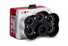
Navvis是室内空间情报技术和企业解决方案的领先提供商,已发布Navvis Indoorviewer 2.6。此主要软件发布包括一个新的测量工具,该工具使用户可以基于基于现实的浏览器数字建筑物中的点云进行高度准确的测量。该版本还使结构化的E57点云文件可用,包括自动生成高度详细的平面图和路由。
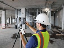
Navvis Indoorvieweris a popular deliverable among building stakeholders without the technical expertise to work with point clouds and modeling software, thanks to the realistic digital buildings and intuitive interface. One of the features that has proven to be useful among users across multiple industries is the measurement tool. It enables users to take measurements remotely on any device, saving time otherwise spent traveling to the site.
Accuracy and usability
With the release of version 2.6 ofNavvis Indoorviewer, the Germany-based company aims to reach a major advance in the accuracy of virtual measurement tools. The tool has been redesigned to overcome two of the biggest problems with virtual measurement tools – accuracy and usability. On the one hand, point cloud measurements are quite accurate. But often these software tools are not accessible or even usable for a wide range of building stakeholders who lack the expertise in working with point clouds. If, on the other hand, the tool uses images or even meshes, which are more user-friendly than point clouds, the tools are usually not reliable enough to produce accurate results.
Navvis Indoorviewer中的新测量工具是为了结合两全其美的新测量工具,这要归功于在现实的360°视图中进行测量时出现的申请申请的放大功能。放大功能揭示了图像后面的点云的确切部分,并让用户选择点云点作为测量的基础,同时受益于完全沉浸式演练的直观接口。
“When redesigning the measurement tool in NavVis IndoorViewer, we wanted to make sure that a wide range of stakeholders in every industry that works with built environments could benefit from the accuracy of point clouds when taking virtual measurements,” said Georg Schroth,NavVisCTO。“我们相信,Navvis Indoorviewer中的新放大功能可以实现我们的目标。现在,即使是不熟悉点云的利益相关者也有一种简单,直观的方式,可以根据这些高度准确的现实世界数据进行测量。”
完全沉浸式3D演练
除了在远程测量的准确性方面取得进步外,该工具的界面还已完全重新设计。这包括一个新的滑块功能,可让用户查看2D平面图和3D演练并排演练,或者从一个视图移动到另一个视图。双重视图提供了整个建筑物的概述,以便用户可以轻松地定位资产或区域,同时还可以在现实的360°视图中查看位置。完全身临其境的演练使实际上可以通过测量的区域移动或检查资产,就好像用户在现场一样。在两种观点中都显示了测量。
Navvis Indoorviewer 2.6的发布还引入了静态扫描仪捕获的E57点云文件的新功能支持。先前的Navvis Indoorviewer版本包括一项流行功能,该功能使激光扫描专业人员上传结构化的E57点云文件,并自动生成可实现的,完全沉浸式的360°演练,可以发布并与客户共享为基于Web的链接。
With the launch of NavVis IndoorViewer 2.6, two popular features that were previously only compatible with scan data captured by NavVis hardware are now available for point clouds uploaded as structured e57 files. The first is the generation of a navigation graph, which makes it possible to turn static scans into a fully immersive indoor routing tool. The second is the automatic generation of highly detailed floorplans. Now point cloud files uploaded as structurede57 filescan be turned into digital floorplans in a few clicks.