ISPRS Congress Will be Hybrid in 2022
接下来ISPRS国会将在好,弗兰ce, from 6-11 June 2022. The ISPRS Congress is the largest scientific event of the photogrammetry, remote sensing and spatial information science fiel...
Indoor mapping is a novel concept that uses a digital 2D or 3D map to represent an indoor venue and spatial information. Indoor positioning and navigation are made possible by presenting places, people, and assets on a digital map. As a result, many various use cases are possible, allowing businesses to improve their workflows and efficiency.

接下来ISPRS国会将在好,弗兰ce, from 6-11 June 2022. The ISPRS Congress is the largest scientific event of the photogrammetry, remote sensing and spatial information science fiel...

Diversity and inclusion (D&I) are high on the FIG agenda, and this was reflected in one of the keynote sessions during FIG Working Week 2021. The session was thought-provoking on what everyone can do ...
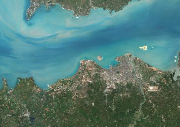
PlanetObserver has released PlanetSAT Global 2022, a basemap that provides ready-to-perform, cloudless and homogeneous imagery. With outstanding 10m resolution, PlanetSAT Global imagery basemap provid...
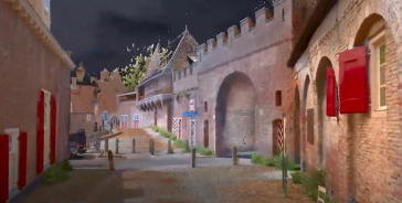
4Indoor has used a wearable NavVis VLX mobile mapping system to create a high-quality 1.2GB point cloud of the medieval gateway called Koppelpoort in the Dutch city of Amersfoort. 4Indoor, a 3D measur...
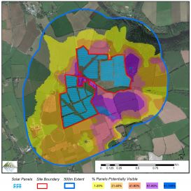
3D maps derived from the latest aerial photography are being used to secure planning permission for solar farms across the Republic of Ireland. Created by Bluesky International, the digital terrain an...
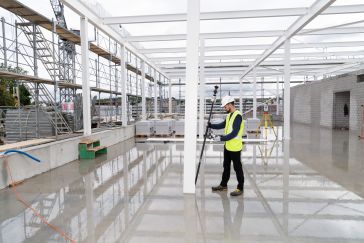
Leica Geosystems, part of Hexagon, has introduced the Leica AP20 AutoPole, an innovative solution for automated total stations that boosts productivity to the next level through tilt compensation, aut...
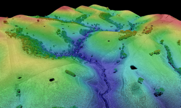
The Digital Twin Victoria (DTV) Program is investing over AU$4 million in new Lidar surveys across the Australian state of Victoria to support a range of land and infrastructure management activities....
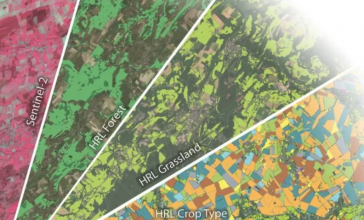
The European Environment Agency (EEA) recently awarded a contract to implement the new High-Resolution Layer (HRL) Vegetated Land Cover Characteristics (VLCC), as part of the pan-European Copernicus L...
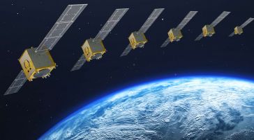
Airbus has successfully completed the Preliminary Design Review (PDR) for its system concept for the second-generation Galileo navigation satellites. During this important milestone, Airbus' proposed ...
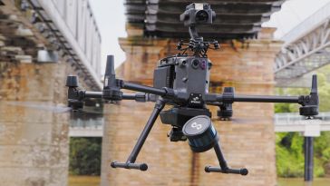
Emesent has launched Hovermap ST, the latest version of the Hovermap autonomy and mapping payload. The tough, lightweight, IP65-rated Hovermap ST includes Emesent’s new automated ground control fea...
This site uses cookies. By continuing to use this website, you agree to ourCookies Policy.Agree