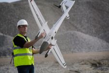
Viametris介绍vMS3D车辆
Viametris, a leader in mobile scanning technology, has announced the introduction of their new mobile scanning system for vehicles, the vMS3D. The mobile mapping system is dedicated to outdoors, roads and urban areas utilising innovative technology for localisation not dependent upon GNSS receivers and poor GNSS reception quality is no longer a problem.
这个technology is no longer tightly dependent on GNSS receivers. Based on unique technology, and years of expertise in indoor mobile scanning, Viametris has become a leading expert in mobile scanning in GNSS-denied environments. Mobile mapping systems allow rapid measurements, faster than any other technologies. But one main issue remains: what happens in urban canyons and poor GNSS cover areas. Thanks to post-processing software PPiMMS and improved trajectory using Simultaneous Localisation And Mapping (SLAM) technology, Viametris has addressed the issues of poor or no GNSS coverage.
Localisation and mapping
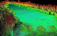
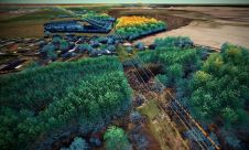
SLAM is an algorithm developed for the robotics industry however it became evident that it can be applied to other disciplines. The principle uses either image or Lidar based localisation to determine the distance between the sensor and surrounding objects. Feature based SLAM uses corners or particular shapes to calculate the position of the sensor however in areas without feature to locate such as land fields or wide open area this approach falls short, said Jerome Ninot, president and founder of Viametris. Lidar based SLAM uses all points from the Lidar point cloud and finds the best position of the sensor by minimising the difference from frame to frame. The advantage of this approach is the ability to scan any type of environment. Moreover it is easier to merge it with other approaches such as integrating IMUs or DMIs and ground control points to achieve greater accuracy in areas not suited to SLAM.
PPiMMS post processing software manages the dataset coming from the system. Its mission is to calculate, control and improve the trajectories. The user can manually add GCPs to constrain the result when GNSS reception is poor. But, in most cases, the user will be able to include postprocessed global positions using GNSS Post-Processing Software. Additionally, the panoramic camera can be used to colourise the point cloud using PPiMMS.
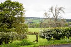
The vMS 3D is designed for surveys in any condition including Urban Canyons with poor GNSS signal, Highways and Freeways, Large scale areas with open-skies, Construction site with open-sky areas, and Optimal GNSS reception.
Applications
- Traditional land surveys: Topometric measurement for as-built or Construction progress
- Autonomous vehicle advanced maps: Knowledge road database to help robots to relocalise themselves on the road
- Mapping and Navigation: To create itineraries of trucks or special vehicles, measuring outages and localising POI
- Road Inventory: Knowledge of road features need efficient tools to collect them efficiently
Make your inbox more interesting.Add some geo.
Keep abreast of news, developments and technological advancement in the geomatics industry.
Sign up for free