充分利用UAS技术的好处
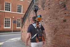
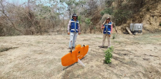
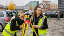
要求在调查和工程领域利用UAS技术。满足准确性和问责制的期望需要最好的专业知识,方法和设备。现在,最新的无人空中系统(UAS)摄影测量硬件和软件现在使测量师能够在地面上捕获数百万次测量测量,以前他们只能测量数百个测量。必须拥有最佳质量的设备,软件和工作流程,以确保这些数据准确,健壮且可辩护,以供专业使用。
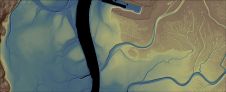
Geosyntecis a leading consulting and engineering firm that works with private and public sector clients to address new ventures and complex problems involving our environment, natural resources and civil infrastructure. UAS technology is becoming a key complement to the innovative technical solutions Geosyntec provides to its clients. From initial site inspections, engineering design and analysis to improving construction quality assurance and project earthwork productivity assessment, leveraging in-house high-accuracy UAS mapping capabilities is proving to be invaluable in countless projects.
专业映射应用程序的强大工具包
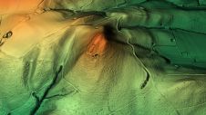
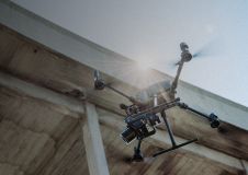
设置正确的UAS摄影测量任务框架对于成功至关重要。这包括高质量的调查级设备和软件。Geosyntec看到KlauPPKas an integral part in bringing this all together. This system includes a high accuracy PPK system, calibrated camera, and post processing software to manage PPK processing with 3D lever arm corrections, coordinate systems, and field QC checks.This combined with quality survey-grade TrimbleGNSS硬件和软件,UGCS Mission Planning软件,PIX4D摄影测量处理,原始地形邮政处理虚拟测量师,以及与Autodesk Civil 3D的最终分析,所有这些都合并为一个用于专业地图应用程序的强大工具包。
Frontier Precision在支持GeoSyntec以找到正确的调查技术选择方面发挥了重要作用,包括Trimble和Klau Geomatics的GNSS调查设备。几十年来,Frontier一直在帮助测量师和工程师获得优质的调查技术。
Geosyntec继续接受最新的“无人飞行系统”技术nology in their progressive roadmap. They will soon be testing the latest from Klau Geomatics, which includes NovAtel Terrastar-C Pro PPP technology, cloud-based post processing, and a custom gimbal/trigger system to enable a Sony RX1R2 42 MP camera on their DJI Matrice 200 Drone.
总部位于加利福尼亚州圣地亚哥的Geosyntec顾问的项目地理空间科学家Michael Carlson表示:“我们继续保持UAS和GNSS技术应用的最前沿,这对于保持我们的业务优势至关重要。”