Newly Launched Leica GNSS RTK Rover Equipped with Visual Positioning
Hexagon的一部分Leica Geosystems揭示了Leica GS18 I,这是一种多功能的GNSS RTK ROVER,具有视觉定位。GS18 i允许用户从现场或办公室中的图像捕获距离和测量点的兴趣点。
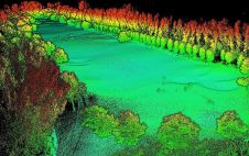
视觉定位技术 - 结合GNS,IMU和相机的传感器融合,使用户可以安全有效地达到以前无法接近或阻塞点。视觉定位基于摄影测量技术,具有近乎实时的数据处理,使测量师可以在现场检查其数据质量。
“这GS18 Iand the workflow in Infinity opens even more new possibilities for us to capture and measure everything we need. It can help fill the data gaps common with traditional GNSS systems that often require supplemental field locations with a total station to complete an area being surveyed. Now you can have one piece of equipment to carry out several jobs on site with fewer equipment setups,” said Donald Smith, P.L.S., senior project manager and principal at BL Companies. “The survey is performed more efficiently as the GNSS crew can capture all detail, even areas with limited access. No data is missed because points can be extracted through Infinity later in the office.”
GNSSRTK Rover with Integrated Visual Positioning
GS18我继续倾斜的Leica GS18 T Rover的成功。除了视觉点定位外,GS18 I还继承了GS18 t的所有功能,包括能够用倾斜或升级的极点绘制和放置点的能力。
“我们设计了GS18我测量专业s who need to measure points that previously could not be measured easily and accurately with GNSS and for those who want to capture the environment quickly and decide later which points shall be measured,” said Bernhard Richter, vice president of geomatics at Leica Geosystems. “With this world’s first GNSS RTK rover with integrated visual positioning technology, Hexagon brings GNSS technology to new user segments while increasing safety, speed and productivity.”
GS18用户可以在现场使用更少的时间,并在办公室中使用Leica Infinity软件继续测量点,从而节省了昂贵的现场时间。如果出现了新的测量需求,测量师可以测量捕获图像中的其他点。GS18我与Leica Caintivate Field软件一起使用,用于捕获图像,现场点测量和质量保证。用户可以超越测量点,并从同一图像中创建自动注册并引用3D点云,并继续使用其他3D软件。