HxGN Content Program Enables Machine Learning and Advanced Analytics
This article was originally published inGeomatics World.
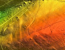
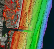
The HxGN Content Program conveniently provides subscribers access to its aerial imagery library covering the United States and large parts of Europe through the Streaming Service or via direct pixel delivery. Each dataset is ortho-rectified, accurate, and available at multiple resolutions ranging from 15cm to 30cm GSD. In addition, stereo imagery and Digital Surface Models (DSM) of various resolutions are offered to assist with 3D modelling.
Already well-established as a source of orthophotos for use in geographic information systems (GIS), the value of high-resolution aerial imagery has moved far beyond visualizations. TheHxGN Content Programis an excellent source of large quantities of highly accurate and consistent data to train machine learning algorithms. Artificial intelligence (AI) expands the opportunities for numerous applications that benefit from automated extraction of valuable information.
Benefits of aerial imagery for machine learning
Machine learning and artificial intelligence provide the efficiency to perform analytical tasks that are beyond the capabilities of human beings. By training algorithms to automatically recognize attributes unique to an object, feature extraction, analytics and other measurements can be applied to imagery to produce actionable, location-based information.
However, machines are confused by variations in data, such as data source, resolution, seasonal differences or radiometry. Therefore, machine learning algorithms depend on large, consistent data sets to be successful. Hexagon achieves consistency by emphasising repeatability in sensor technology, flight planning, acquisition parameters, and processing techniques. Hexagon normalizes its datasets to offer consistent input so that engines can focus on detecting the correct objects. Entire states and regions are collected in the same season to avoid a patchwork of irregular images.
Make your inbox more interesting.Add some geo.
Keep abreast of news, developments and technological advancement in the geomatics industry.
Sign up for free